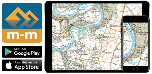
Great Britain – OS maps
The complete Ordnance Survey digital mapping solution for all your devices
Intuitive and easy to use software for Windows PC, Mac, iOS and Android, with full GB coverage. Once the maps are downloaded, they may be used offline without any need for an internet connection.
Available OS maps
2026 Edition maps on SALE now!
- OS 1:50,000 map (uses the exact same mapping as the OS Landranger Maps): ideal for exploring by car or bike. It does not show as much detail as the 1:25000, but you’ll still find footpaths, rights of way and tourist information features, and of course pubs!
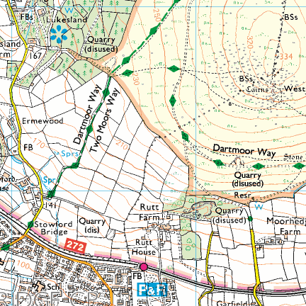
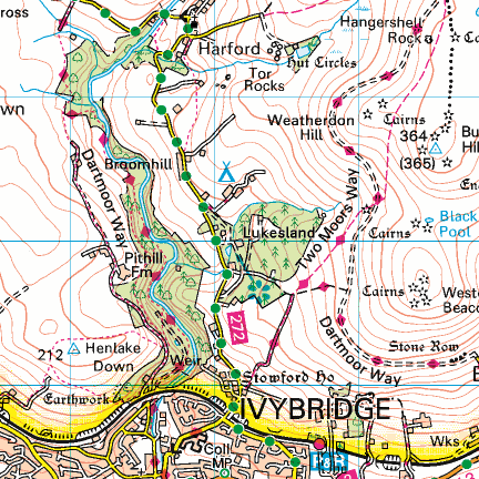
- OS 1:25,000 map (uses the exact same mapping as the OS Explorer Maps): the most detailed topographic map, showing footpaths, rights of way, field boundaries, open access land and the vegetation on the land. It is ideal for walking, running, horse riding, off-road cycling.
- Ordnance Survey Street map: a detailed backdrop map for Great Britain, which has been derived from large scale OS data. It provides a street-level, colour map that has been specifically designed to emphasise road carriageways, road names, and also highlights notable public buildings.
- OS 1:250,000 Road Map of Great Britain: FREE small scale basemap showing terrain and major roads
Free Trial
Use the Digital Map Store in our apps to obtain a free trial of any of the OS maps.
Perpetual licence or Annual Licence
Click the links below for the current map prices
- Buy OS 1:25k (On Sale from £24.98)
- Buy OS 1:50k (On sale from £17.50)
- Buy OS Street Map (from £9.99)
- Buy Platinum Bundle (all of the above maps, On sale from £29.99)
You can choose between a Perpetual or an Annual Subscription licence. Both have the same offline maps, the same software features and allow use on all your devices.
The Perpetual Licence allows you to use the purchased edition of the maps without any expiration. It does not include any updated editions, but we do sometimes offer a discount to buy a update. This is the same type of licence that we have been offering in years past.
The Annual Subscription allows you to use the maps for 1 year from the time of purchase (or from registration in the case of a gift certificate purchase). During the subscription period you can use new updated editions of the same maps. Once the maps are downloaded, they work offline, exactly the same as the perpetual edition. You don’t need an internet connection to use them. As the subscription nears its expiry date, you are prompted to renew the subscription. The annual purchase is one payment that you have to complete on our web site. We don’t use any automatic recurring payments. Subscription licences were new in 2020.
Memory-Map OS maps are licensed for a single user, non-commercial use on up to 5 devices (any combination of Windows PC, Mac, iPhone, iPad or Android).
Memory-Map Features
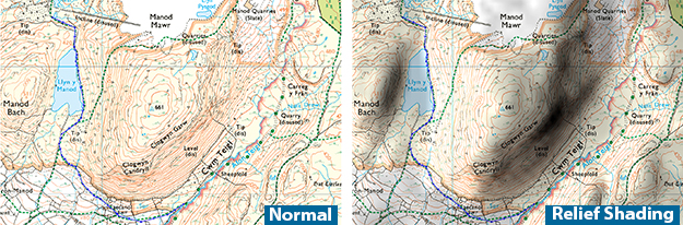
- Route Planning – Simple tools let you create and manage routes, tracks and waypoints. Use the relief shading tool to quickly see the shape of the terrain.
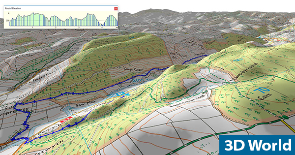
- 3D World – Create your own 3D maps, hill profiles and fly through 3D terrain. Useful tools allow you to customise the light direction, sky colour and more to produce your own unique maps.
- Print – Print unlimited maps with your own notes and route cards using multi-page and hill shading options. We recommend using waterproof paper.
- Transfer – Download maps to your mobile or tablet and CloudSync routes, tracks and waypoints.
- Navigate – Install the Memory-Map for All app and turn your mobile into an outdoor GPS (or connect a GPS to your laptop) complete moving maps and DigitalGPS™ data displays.
- Review – Check tracklogs from your mobile or GPS to see where you’ve been, speed and distance covered.Share your favourites online using GPX format
CloudSync enables you to transfer routes, marks and tracks to and from your mobile devices via the internet ‘cloud’ rather than having to email or connect your device.
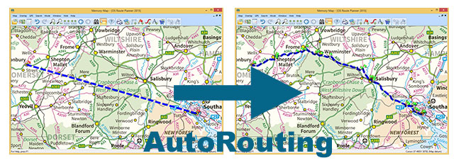
AutoRouting. Create a rough route, even just a straight line A to B, and then choose to Optimise Route for Driving, Cycling or Walking and Memory-Map will create a more detailed route for you automatically. The online database is great for car journeys and being improved all the time for walking and biking.
This product is licensed for personal non-commercial use. Memory-Map also offer multi-user licences for commercial, education, public sector and SAR organisations, for more information please Contact Us